
Garmin GPS 76 Handheld GPS Navigator
4.6Editor score
WAAS enabled receiver
12 satellite tracking
16 hours battery life
Navigating the open water requires reliable technology to ensure safety and efficiency. A quality marine GPS unit provides essential location tracking, mapping, and often sonar capabilities to help you find your way and locate fish with precision.
We have analyzed ten top-rated models based on display quality, mapping accuracy, sonar performance, and connectivity options. Each entry represents a distinct choice for different boating styles, from handheld portability to large chartplotter systems.
Our picks highlight specific strengths like rugged design, high-resolution scanning, or extensive ecosystem integration. Please note that specific pricing may fluctuate over time, so checking current offers is advisable before making your final purchase decision.
4.6Editor score

4.4Editor score

5.0Editor score
As an Amazon Associate we earn from qualifying purchases.
This side-by-side comparison breaks down the core specifications of each model to help you quickly identify which unit matches your specific boating needs and budget requirements.

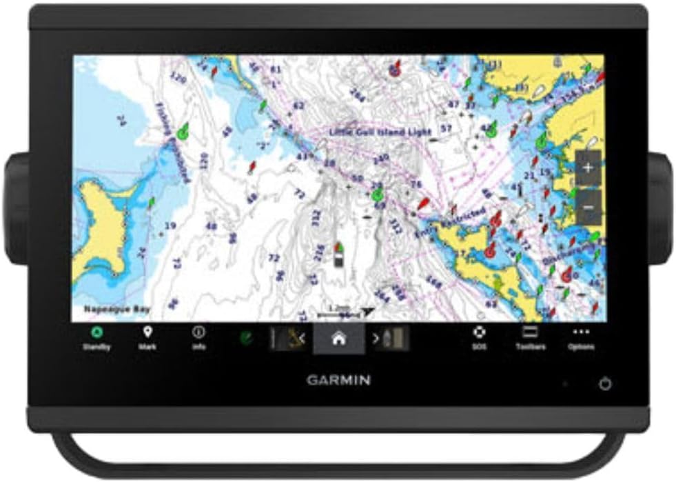


This multifunction display offers a robust combination of navigation and fishing tools right out of the box. With a strong rating and versatile features, it stands out as a top choice for sportboats and center-consoles seeking reliability.
We may earn a commission when you buy through this link, at no additional cost to you.
The included C-MAP Discover card provides full-featured vector charts with detailed bathymetric contours. The 83/200 kHz HDI transducer ensures clear CHIRP sonar and DownScan Imaging to help identify bottom structure and fish targets effectively.
While it excels in connectivity and mapping, adding radar requires purchasing separate options. Additionally, initial system setup can be slightly complex for first-time users but pays off with deep integration.
It is ideal for boaters who want a single unit to handle both navigation and fishing without needing multiple devices. We recommend this for those valuing high-resolution maps and seamless network integration.
The C-MAP Discover card offers ultra-wide coverage in the US and Canada with custom depth shading and tide data.
Built-in Wi-Fi and NMEA 2000 support allow you to mirror displays and integrate other marine electronics effortlessly.
We may earn a commission when you buy through this link, at no additional cost to you.
This unit delivers a bright, sunlight-readable touchscreen that makes reading charts easy even in harsh conditions. Its high rating reflects strong performance in both navigation and fish-finding capabilities.
We may earn a commission when you buy through this link, at no additional cost to you.
The included GT56 transducer supports Garmin traditional, ClearVü and SideVü scanning sonars, providing detailed underwater views. Built-in Wi-Fi lets you share sonar data and routes wirelessly between units or devices.
While the coastal charts are detailed, users needing global maps might need upgrades. The premium price point is justified by the included transducer and superior display quality for serious anglers.
Ideal for those who prioritize screen quality and want a complete package without buying extra sensors. We suggest this for boat owners looking for a modern, connected fishing experience.
You can wirelessly connect to your Force trolling motor to control speed and navigate to waypoints directly from the screen.
The included transducer offers both traditional sonar and high-resolution scanning for comprehensive underwater imaging.
We may earn a commission when you buy through this link, at no additional cost to you.
This chartplotter is designed for anglers who demand the best underwater imaging available. With ultra high-definition scanning sonar, it reveals detailed views of fish and structure below the boat.
We may earn a commission when you buy through this link, at no additional cost to you.
It supports Panoptix sonar which allows you to see fish live, in real-time, adding a dynamic layer to your fishing strategy. The improved display optics ensure that data remains clear even in bright sunlight.
While the unit comes with pre-loaded mapping, you will need to purchase a transducer separately to enable the sonar features. Installation requires technical know-how to set up the network correctly.
Perfect for serious anglers upgrading their setup with top-tier sonar capabilities. We recommend it for users who already have Garmin systems and want to add high-performance scanning.
Support for Panoptix allows for real-time sonar imaging, showing you moving fish as they swim near the boat.
The improved optics provide better contrast and viewing angles for comfortable operation over long hours.
We may earn a commission when you buy through this link, at no additional cost to you.
This comprehensive package combines a large chartplotter with a radar dome for complete situational awareness. It allows you to build a sophisticated marine system with superior network connectivity options.
We may earn a commission when you buy through this link, at no additional cost to you.
You can expand engine compatibility and connect third-party devices via OneHelm digital switching. The Navionics+ charts help you explore any waters with confidence and detailed mapping data.
While the radar is a huge plus, the high cost may be prohibitive for smaller boats. Installation often requires professional help to ensure all systems communicate correctly.
Ideal for larger vessels needing a full suite of navigation tools including radar. We recommend this for captains who value safety and remote monitoring capabilities.
The included GMR 18 HD3 radome offers high-definition radar for detecting other vessels and obstacles at sea.
OneHelm digital switching lets you manage your boat's systems directly from the chartplotter interface.
We may earn a commission when you buy through this link, at no additional cost to you.
This handheld offers essential navigation tools without the complexity of a full chartplotter. It is rated highly for reliability and simplicity, making it perfect for day boaters or kayakers.
We may earn a commission when you buy through this link, at no additional cost to you.
It uses a WAAS enabled receiver to track up to 12 satellites for precise location data. You can download optional data via MapSource to expand your maps for different regions.
While it lacks a touchscreen and advanced sonar, it provides up to 16 hours of power from standard batteries. The simplicity means it is easy to use even for beginners.
Best for those needing a reliable backup or basic navigation without spending much. We recommend this for casual users who need dependable tracking on the water.
Built-in trip computer tracks current speed, average speed, and total trip distance for easy trip management.
You can download data from CD-ROMs to add more detailed maps to the device as needed.
We may earn a commission when you buy through this link, at no additional cost to you.
This handheld GPS combines rugged durability with detailed coastal mapping for reliable navigation. It is designed to float if dropped, adding safety for water-based activities.
We may earn a commission when you buy through this link, at no additional cost to you.
With preloaded BlueChart g3 coastal charts, you have immediate access to detailed depth contours. It supports multiple satellite constellations for reliable tracking around the world in various conditions.
While the battery lasts up to 20 hours, the device is heavier due to the mapping capabilities. Users note the rating is lower perhaps due to interface complexity compared to simpler models.
Ideal for adventurers needing a map-backed GPS that survives the elements. We recommend this for kayakers or sailors who need maps and durability in one tool.
The rugged design ensures the unit floats if accidentally dropped overboard, preventing costly loss.
Supports GPS, GLONASS, and other systems for reliable tracking anywhere globally.
We may earn a commission when you buy through this link, at no additional cost to you.
This handheld offers essential tracking in a durable, floating case. It is ideal for general navigation where detailed charts are not strictly necessary for your journey.
We may earn a commission when you buy through this link, at no additional cost to you.
It includes a worldwide basemap that covers global coastlines. The built-in electronic compass shows heading even when standing still, aiding in orientation without moving.
While it lacks detailed coastal charts, the simplicity means easier operation for quick trips. The fogproof glass ensures readability even in humid conditions or rain.
Best for users needing a simple, durable GPS for basic tracking. We recommend this for campers or boaters who need a reliable backup navigation tool.
The electronic compass provides accurate heading data without needing to move, which is useful for stationary navigation.
Fogproof and scratch-resistant glass protects the display from rough handling and weather conditions.
We may earn a commission when you buy through this link, at no additional cost to you.
This 10-inch unit offers a large, clear display for viewing navigation data. It is highly rated for its build quality and ease of integration with other systems.
We may earn a commission when you buy through this link, at no additional cost to you.
It comes with a basemap included, so you can start navigating immediately. You can add transducers or radar separately to expand its fish-finding capabilities later.
While the screen is excellent, you must purchase sonar hardware separately for fishing features. The higher cost reflects the quality and larger size compared to 7-inch models.
Ideal for those who want a big screen for navigation and plan to add sonar later. We recommend this for boat owners planning a modular upgrade path.
A 10-inch screen offers ample space for detailed chart viewing and split-screen functionality.
Compatible with various Garmin add-ons to grow your system as needs change.
We may earn a commission when you buy through this link, at no additional cost to you.
This unit achieves a perfect user rating due to its exceptional screen quality and sonar performance. It represents the pinnacle of marine navigation for those who demand the best.
We may earn a commission when you buy through this link, at no additional cost to you.
The 12-inch IPS panel remains bright and clear even in direct sunlight. Built-in CHIRP sonar and scanning features provide detailed views of fish and structure below the boat.
While it offers advanced connectivity like J1939 and Wi-Fi, it requires a significant investment. Setup can be complex, so professional installation is often advised.
Best for serious captains needing top-tier technology and reliability. We recommend this for vessels where safety and high-end performance are paramount.
IPS technology ensures viewing angles and color accuracy remain high across the entire 12-inch display.
5000-watt CHIRP sonar provides excellent target separation even in deep water.
We may earn a commission when you buy through this link, at no additional cost to you.
This compact chartplotter offers detailed mapping without fish-finding sonar. It has a perfect rating for users needing reliable navigation in a smaller footprint.
We may earn a commission when you buy through this link, at no additional cost to you.
It includes Navionics+ charts which provide highly detailed coastal data. The improved optics ensure the display remains clear and readable in various lighting conditions.
Without sonar, this is best for boaters who prioritize navigation. The compact design makes it easy to mount on smaller dashboards without clutter.
Ideal for kayakers, sailors, or small boats needing quality mapping. We recommend this for those who value simplicity and high-quality charts.
Included Navionics+ charts offer high-resolution data for coastal navigation and points of interest.
The 7-inch footprint allows for easy installation on boats with limited dashboard space.
We may earn a commission when you buy through this link, at no additional cost to you.
Selecting the right navigation system depends on your boat size and needs. Consider these factors to find the best fit for your time on the water.
Larger displays are easier to read in sunlight and provide more detail. Look for bright screens with high resolution and viewing angles suitable for outdoor use.
Choose a screen size that fits your dashboard but remains readable from a distance.
If you fish, sonar capability is essential. Check if the unit includes a transducer or requires one to be purchased separately.
Ensure the sonar supports technologies like CHIRP for better target separation and clarity.
Navigation depends on accurate maps. Verify if the device comes with preloaded charts or requires a separate card.
Look for coverage of the specific waters you frequent, such as coastal or inland lakes.
Modern units connect to various sensors and autopilots. Check for support of NMEA 2000, Wi-Fi, and Bluetooth.
Seamless integration allows data sharing between your GPS and other electronics on board.
Marine environments are harsh. Ensure the unit has waterproof ratings and robust mounting options.
Rugged designs or floating cases are vital for handheld units used on open decks.
For handhelds, long battery life ensures reliability on long trips. Look for models offering 20 hours or more of continuous use.
Consider battery replacement options or rechargeability for extended adventures.
Prices vary widely from basic units to full marine systems. Determine which features are essential versus optional.
Balance initial cost against the value of included accessories like transducers or chart cards.
Complex systems can be hard to use while steering. Look for intuitive interfaces and clear menus.
Touchscreens are convenient, but physical buttons work well when wearing gloves.
Install the unit securely on a stable mount to prevent movement. Ensure all connections for power and data are waterproof and tightened properly to avoid corrosion.
Regularly update the software and map data via Wi-Fi to maintain accuracy. Keeping the device updated ensures you have the latest route and chart information.
Protect the screen from direct sunlight and salt spray. Clean the display with a soft, damp cloth and ensure it is fully dry before powering off.
Many units come with preloaded basemaps, but detailed navigation often requires a specific chart card. Check the product description to see if charts are included or if you need to buy them separately.
A GPS gives your coordinates, while a chartplotter displays those coordinates on a map. Most modern marine units combine both functions into one device for easier navigation.
Phones can be useful but lack the durability, water resistance, and specific marine data of dedicated units. For safety and reliability, a purpose-built marine GPS is recommended.
Yes, marine GPS units work in both fresh and salt water. Most include maps for lakes and rivers, but check the specific map coverage before purchasing.
It is best to update maps annually to ensure accuracy. Most manufacturers offer free updates or subscription services to keep your data current.
Handheld units are easy to install, but hardwired chartplotters require wiring knowledge. If unsure, consult a professional installer to ensure safety and function.
CHIRP sonar uses a range of frequencies to produce clearer images. It helps distinguish fish from structure better than traditional single-frequency sonar.
Most marine GPS units are designed to withstand water exposure. Handhelds often have higher IP ratings to float and stay waterproof if dropped.
We have highlighted ten excellent models ranging from budget handhelds to premium chartplotters. Each option serves different needs, ensuring there is a suitable unit for every type of boater.
Prioritize features like display quality and mapping accuracy to match your specific use case. Investing in the right tools ensures safer and more enjoyable experiences on the water.
Please verify current prices and availability before purchasing as these may change. We hope this guide helps you find the perfect marine GPS for your adventures.